- Cart - 0 items
Cart is Empty.
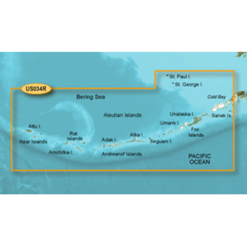
BlueChart® g3 Vision® HD - VUS034R - Aleutian Islands - microSD™/SD™
Coverage:
The Aleutian Islands from Attu Island to Cold Bay, including Adak Station and Unalaska. Also covers the Pribilof Islands, including St. Paul Island and St. George Island.
Premier Coastal Navigation Charts
$297.24
BlueChart® g3 Vision® HD - VUS034R - Aleutian Islands - microSD™/SD™
Coverage:
The Aleutian Islands from Attu Island to Cold Bay, including Adak Station and Unalaska. Also covers the Pribilof Islands, including St. Paul Island and St. George Island.
Premier Coastal Navigation Charts
BlueChart® g3 Vision® HD - VUS034R - Aleutian Islands - microSD™/SD™
Coverage:
The Aleutian Islands from Attu Island to Cold Bay, including Adak Station and Unalaska. Also covers the Pribilof Islands, including St. Paul Island and St. George Island.
Premier Coastal Navigation Charts
Related Products

Copyright © TechBuys All Rights Reserved.