- Cart – 0 items
-
Cart is Empty
-
$175.99
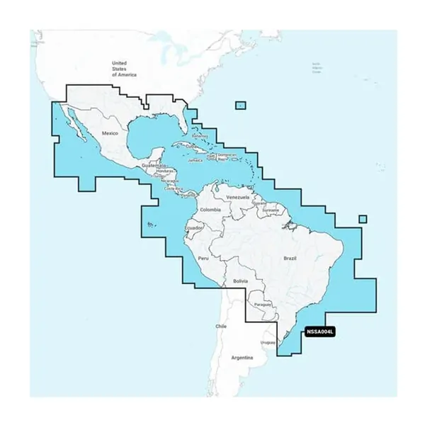
Garmin Navionics+ NSSA004L - Marine Charts for Mexico & Caribbean
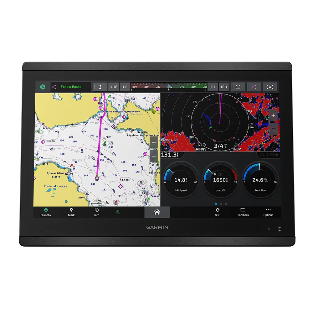
Experience the most comprehensive marine mapping with Garmin Navionics+ cartography designed for your compatible chartplotter. This charting solution offers vibrant colors and a streamlined interface, bringing together coastal and inland navigation to help you plot your course effortlessly.
Enjoy enhanced navigation with multiple shading options for shallow waters, helping you identify optimal fishing spots with ease. The product is fully customizable, allowing you to select from various chart layers and up to ten color-shaded target depth ranges.
Upon purchasing a new Garmin Navionics+ or Garmin Navionics Vision+ product, you'll receive a one-year subscription, giving you access to essential updates.
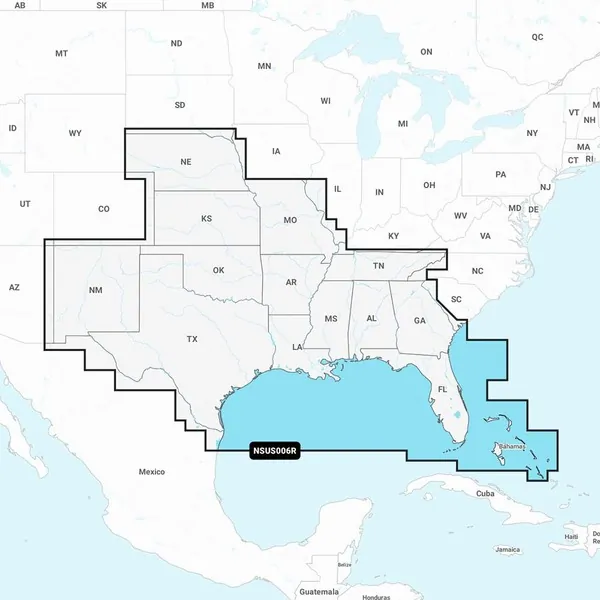
Coverage Area:
This chart provides comprehensive coastal coverage from Mexico to Brazil, including the US Gulf Coast, eastern US coast to Savannah, GA; Bermuda; Bahamas; Cuba; Puerto Rico; the Virgin Islands; Jamaica; and the Panama Canal, among others.
Features:
Garmin Navionics+ NSSA004L - Marine Charts for Mexico & Caribbean
Related Products