- Cart – 0 items
-
Cart is Empty
-
$170.89
Navionics+ Chart - Pacific Islands Coverage
Experience the premier marine mapping solution with Navionics+ cartography tailored for your chartplotter. This comprehensive package is designed for both offshore and inland waters, featuring intricate maps of coastal areas, lakes, and rivers.
With SonarChart™ HD bathymetry providing high-resolution depth maps, advanced features like dock-to-dock route guidance, live mapping capabilities, and Plotter Sync for seamless updates are included. The Navionics Chart Installer ensures your charts are always current with fresh data.
Coverage Area:
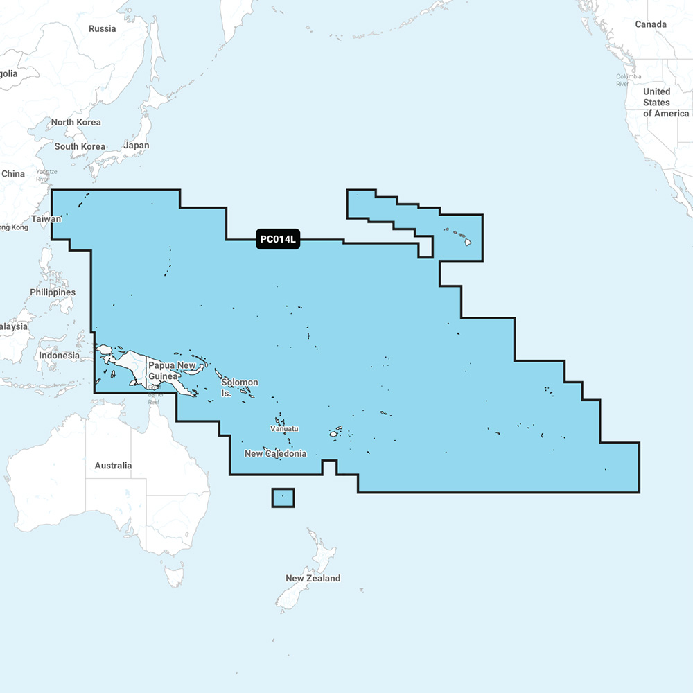
Includes vibrant detail of the Hawaiian Islands, Ryukyu Islands, Papua New Guinea, Solomon Islands, New Caledonia, Fiji, Vanuatu, American Samoa, French Polynesia, Pitcairn Islands, Marquesas Islands, Kiribati, Palau, Marshall Islands, and the Mariana Islands, including Guam.
Product Features:
Navionics+ NAPC014L - Pacific Islands
Related Products