1 x $171.41
- Cart - 6 items
 32GB DDR5 4800...
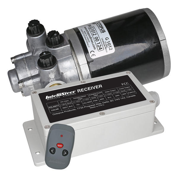 Intellisteer T...
1 x $846.03
 LaCroix Berry ...
1 x $28.09
 DAC Portable L...
1 x $46.86
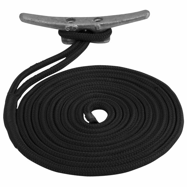 Sea-Dog Double...
1 x $18.00
 Compact LED To...
1 x $34.03
Subtotal: $1,144.42
1 x $171.41
1 x $846.03
1 x $28.09
1 x $46.86
1 x $18.00
1 x $34.03
Subtotal: $1,144.42
$134.74
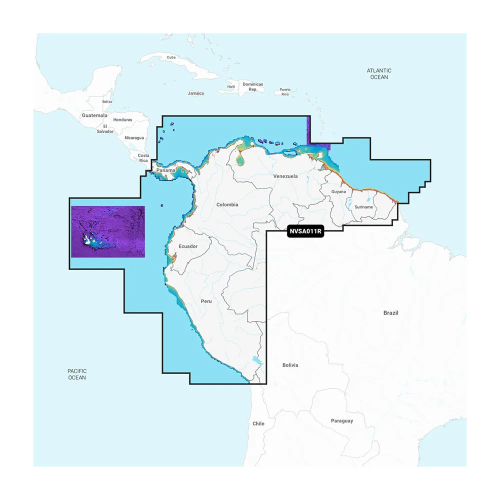
Garmin Navionics Vision+™ NVSA011R South America Updates
Experience enhanced navigation with vibrant colors and an intuitive interface while utilizing the comprehensive coverage of Garmin Navionics cartography. Specifically designed for marine chartplotters, this product makes plotting courses simple and effective.
Coverage Details
Enjoy detailed mapping across the coast of Panama, encompassing the Canal, along with coastal areas of Peru, Ecuador, Columbia, Venezuela, Trinidad and Tobago, Guyana, Suriname, and French Guiana.
Daily Chart Update Access
The included subscription allows users to access daily chart updates through the ActiveCaptain app, enhancing navigation with as many as 5,000 improvements made every day.
Advanced Features
Leverage Auto Guidance+ technology for efficient transport through complex waterways, with features tailored to land navigation improved by Garmin and Navionics expertise.
High-Resolution Depth Shading
Identify up to 10 color-shaded depth options quickly, allowing for quick assessment of target depths.
Precision Contours
Up to 1' contours enhance fishing opportunities by offering detailed views of submerged structures and navigation areas.
Shallow Water Indicators
Stay informed of shallow areas with user-defined shading for better route planning.
Community Insights
Utilize content provided by the ActiveCaptain community, highlighting essential Points of Interest (POIs) like marinas and hazards.
Premium Features Available
Enhance your experience with download options for high-resolution relief shading, satellite imagery, aerial photographs, and 3D visualization tools that provide comprehensive situational awareness on the water.
Garmin Navionics Vision+™ NVSA011R South America Updates
Copyright © TechBuys All Rights Reserved.


