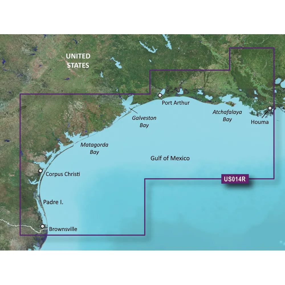
BlueChart g3 Vision HD - VUS014R - Morgan City to Brownsville
Coverage:
This chart covers the area from Atchafalaya Bay to Brownsville, including Port Arthur, Galveston Bay, Matagorda Bay, and Padre Island.
Features of BlueChart g3 Vision:
Industry-leading coverage with integrated Garmin and Navionics data providing high clarity and detail.
Auto Guidance technology helps you plan routes based on your desired depth and overhead clearance.
High-resolution relief shading for a clearer view of underwater features.
Depth Range Shading displays up to 10 depth ranges for easy navigation.
Accurate bottom structure representation with up to 1' contour lines for improved fishing and navigation.
Experience unmatched clarity and coverage on the water with BlueChart g3 Vision, designed for optimal marine navigation.
Additional Features:
NOAA raster cartography downloadable via the ActiveCaptain app for paper-like visuals.
Shallow Water Shading to help identify areas to avoid.
High-resolution satellite imagery for enhanced situational awareness.
Unique 3-D views (MarinerEye and FishEye) providing perspectives above and below water.
Note: Auto Guidance is for planning purposes only. Raster cartography requires compatible devices for viewing.
WARNING: This product may expose you to chemicals known to the State of California to cause cancer and reproductive harm. For more information, visit P65Warnings.ca.gov.
Please contact the manufacturer directly with any issues or concerns, as this product cannot be returned to the point of purchase.
Industry-leading coastal navigation charts.
Integrated Garmin and Navionics data for superior detail.
Auto Guidance technology for route planning.
High-resolution relief shading for enhanced bottom structure visibility.
Depth Range Shading with multiple depth ranges.
Other people marked this product with these tags:
Garmin BlueChart g3 Vision HD - VUS014R - Morgan City to Brownsville