- Cart – 0 items
-
Cart is Empty
-
$176.44
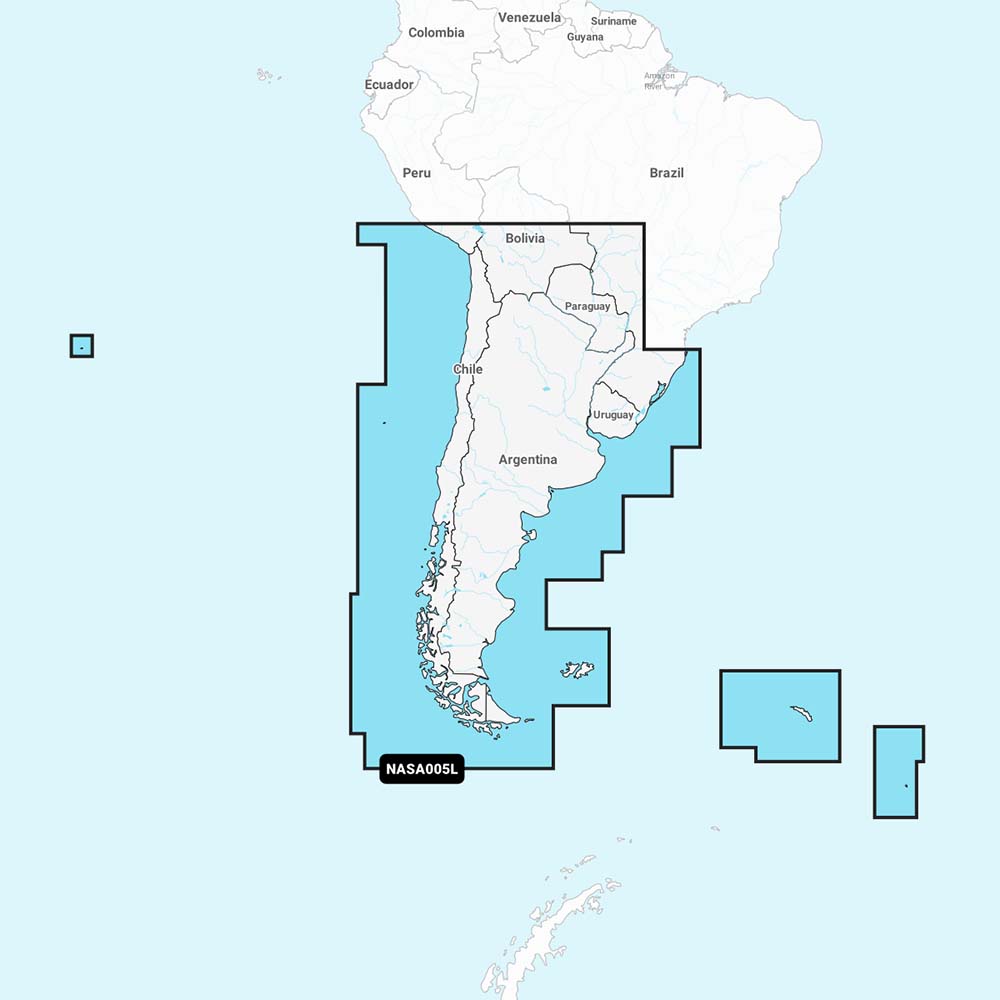
Navionics+ Chile, Argentina & Easter Island - MicroSD Card
This product offers comprehensive coastal coverage of South America, from Arica, Chile to Rio Grande, Brazil, including Easter Island, Cape Horn, the Falkland Islands/Islas Malvinas, as well as South Georgia and South Sandwich Islands, and the Rio de la Plata.
Experience marine mapping with Navionics®+ cartography on your chartplotter. This solution provides detailed integrated mapping of coastal waters, lakes, and rivers. It features SonarChart™ with HD bathymetry maps and functionalities such as dock-to-dock route planning, live mapping, and Plotter Sync for wireless updates. The Chart Installer software ensures your chart data remains current. Utilize route planning solutions to plan suggested paths through various nautical routes. Note that route planning should be used for planning purposes only and does not supplant safe navigation practices. Options for multiple shading enhance shallow water navigation, making it easy to pinpoint depths for fishing.
Features:
NOT FOR USE IN GARMIN CHARTPLOTTERS
Navionics+ NASA005L Chile, Argentina & Easter Island
Related Products